A Geologist's Wet Dream
Iceland is literally like no other place on earth; I mean that from a technical point of view. Let me explain. The earth is made up of layers, the outermost of which is the hard crust we live on. Just underneath the crust is the molten mantel. The crust is broken up into sections on the surface of the earth called tectonic plates. On some areas of the earth these plates bump against each other creating mountains and earth quakes, and in other areas these plates pull apart, with new crust constantly forming between them from the molten mantle. Areas where the plates pull apart are called divergence boundaries, and every single one of them is completely submerged miles beneath the ocean, except for the small portion that rises above the surface of the ocean. That place is called Iceland.
 |
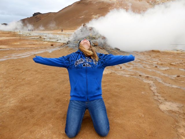
| Evidence of volcanic activity is all over Iceland. Here I present a fumerole, a crack int he ground from which superheated steam fueled by hot magma beneath the surface escapes. |
I visited Iceland while pursuing my PhD in Earth and Planetary Sciences. Needless to say I was super ecstatic about visiting this natural wonder. Due to the magma bubbling up from the earth's mantel divergence boundaries are higher than the rest of the ocean floor, but only in Iceland do they breach the ocean surface. The boundary runs north south straight down the middle of the country, and mostly along this line are all sorts of active volcanic activity, although evidence of past volcanic activity can be found all over the island. This post is about the evidence of volcanic activity I saw all over the island on my counter clockwise journey around it.
 |
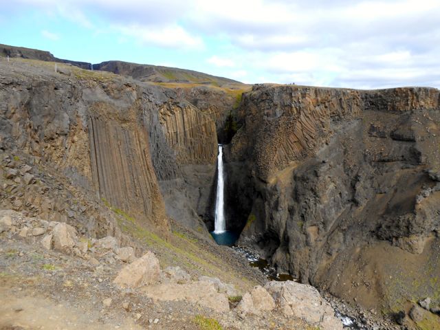
| These basalt columns formed when a lot of magma quickly cooled, breaking into geometric tube-like shapes. They are as large as they are impressive, a few hundred feet long. |
The first evidence of volcanic activity I encountered in Iceland was in the southeastern corner of the country: basalt columns. Basalt is a type of rock that forms when molten magma cools, and when there is a whole lot of magma that cools really quickly it cracks forming long columns of the dark mineral. Basalt columns can be found in many areas of the world, but the columns I saw in Iceland were exceptional, a few hundred feet in height. As awesome as the columns were, they were just the tip of the volcanic iceberg.
 |
| This Icelandic goat grazes near a geothermal power plant, which produces energy out of steam for the island. |
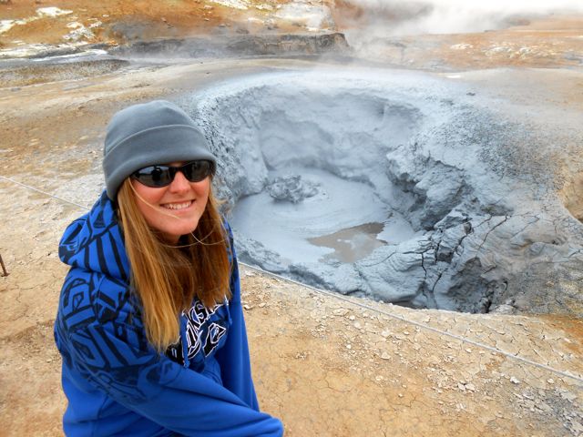
Closer to where the boundary divides the island in half are more active forms of volcanic evidence. On the north side of the island I encountered fumeroles (cracks in the earth that steam escapes from) and bubbling mud pots (the name is self-explanatory). Since the magma is closer to the surface closer to the boundary the magma heats up water infused the shallow crust. The steam escapes through cracks creating frumeroles and puddles creating mud pots. Along with the steam that escapes are other earthy gases, like sulfur gas, which has a smell reminiscent of rotten eggs.
 |
| A bubble of volcanic gases explodes behind me in this mud pot. Smells of sulfur and steam hang heavy in the surrounding air. |
Moving on to the northwest tip of the island I moved away from the escaping steam of volcanic activity but towards more evidence of past vocalism. It was on this tip of the island that I first encountered a pseudocrater (also known as a rootless cone). Pseudocraters are called such because unlike craters formed from explosions of lava pseudo craters form from the explosions of steam, just another way super-heated water vapors escapes from the shallow crust. I've seen lot of fumeroles and mud volcanoes, but this is the only time I've encountered a pseudocrater.
 |
| Theses pseudo craters formed when huge explosions of steam broke the ground's surface. |
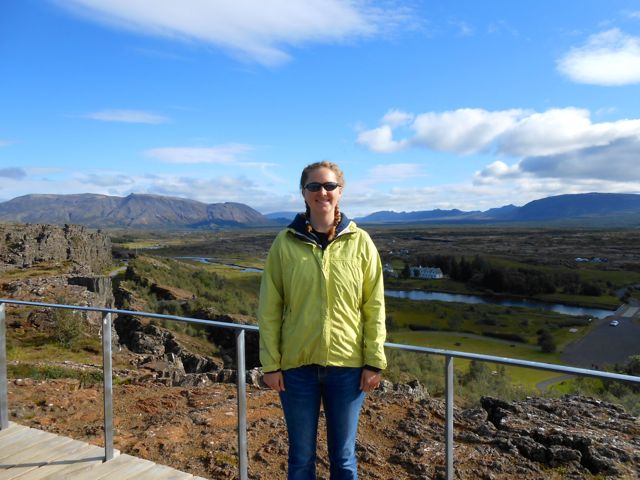
The final and most exciting piece of divergence boundary evidence (at least for me) I encountered on the southern coast of Iceland a little over an hour's drive east of Reykjavik. It was the great rift valley, also an Icelandic national park. To the untrained eye the national park just looks like a valley, with steep broken cliffs on either side. To someone who knows what they are peering at however, they will see the west cliffs of the valley as the tip North American Tectonic Plate and the east cliffs as the edge of the Eurasian Tectonic Plate. The no man's land between the two, a bright green and floral valley floor with creeks and ponds, is where molten rock from the earth's interior is rising up and forming new land.
The broken and fractured cliffs on the sides of the valley are a testament to how fast land is being created and moved. The ground is constantly stretched and pinched as new land forms at a non-uniform rate. This causes huge fractures in the cliffs. Fractures large enough for a person to walk through, which we did on our hike to the valley floor.
 |
| The fractured cliffs in this area are a result of the ground being pulled and pinched in several directions. |
As awesome as exploring the tectonic activity of Iceland was, it only occupied a fraction of the week I spent exploring Iceland. Look for more posts about this awesome island country soon.
I also want to take this moment to say thank you to Bob and Terry again for taking me on this awesome trip. It still stands as one of my favorite countries.
I also want to take this moment to say thank you to Bob and Terry again for taking me on this awesome trip. It still stands as one of my favorite countries.

No comments:
Post a Comment